Street maps for printing
Printable and Editable city maps
Find and download your maps
City Maps
Mapping a solution for you
A map gives insight on all sorts of levels. Whether it is you want to translate an Excel sheet to a visual image, or be it you need a custom map, with either locations, regions or routes, we can arrange all of this in heartbeat. We dont shy away from anything when it comes to cartography and map making, try us! Here you will find a Santa Clara printable maps in PDF and Adobe Illsutrator, printable maps of San Luis Obispo, and Charleston maps in PDF as well.
Editable multi-layered digital maps for graphic illustrations, websites and presentations. Please also visit a full collection of Printable city maps in PDF & Adobe Illustrator.
Not sure which map it is you need? Browse through a wide selection of maps. Products range from simple 'Area Maps', 'Location Maps', 'Region Maps' to fully interactive 'Web Maps'. Whatever map you need, can surely be found here.
Here you'll find the more standard and basic maps around. All files are digitally for sale in both EPS and JPEG format. These maps include: World Maps, Continent Maps, Country Maps, City Maps and more. Is the map you're looking for not around? Chances are we're working on it.
A map is valuable for ist ability to convey information. Too much and is illegible; too little, and the map isn`t very useful. Layered vector maps are used by designers to make maps more usable. Layers are easy to turn on and off on your editable maps.
If we want to see the world as a whole, we can only do so by using outstretched cilyndrical world maps. Most of the time these world maps are not very accurate and most of the deficiencies occur close to the North and South Poles. The first group of our line maps consists of the basic maps where next to the several free maps we see those that have the usual grids and the famous latitudes can be seen as well.
The detailed US-state maps show the country borders, the counties, rivers, lakes, the names of the rivers and lakes, the towns and the symbols meaning certain towns, the interstate highways, major roads and express ways on a separate layer. Because these are vector-graphic maps they can be modified, painted and resized without loss of resolution. Most US-state maps can be downloaded in Adobe Illustrator (10), PDF and JPG formats.Every US state has links to its neighbor states that can be found easily.
Wide Choice of Vector Map Styles
We offer you four popular map styles, but should you wish another map style (or size), please contact us and we will create a map that is completely customized to your needs.
Adobe Illustrator Map Format - The Best Format for Mapping
AI Our Illustrator maps are designed so it is easy for you to modify the map to suit your project.
Areas (such as states or countries) are complete objects so you can add or change color fill
Lines are fully editable
Text is fully editable font text (not outlines) so you can change font, size and style
All features are in layers that you can turn on and off.
Content Page
All of our editable Savannah vector maps are instantly downloadable digital files in either editable PDF or Adobe Illustrator format. Because each of our Savannah digital maps is available in the Adobe Illustrator or editable PDF format, both of which use a vector based approach to displaying images, you can easily zoom into any portion of our maps without any degradation in the quality of the text, lines and symbols of the map --- regardless of the magnification factor. Using a vector graphics editor such as CorelDraw, Freehand or Illustrator, you can then easily crop portions of your map, add custom symbols, and change colors and font attributes as you need. We have a wide-variety Savannah vector maps with varying levels of detail from simple blank outlines to highly-detailed maps with roads and terrain layers.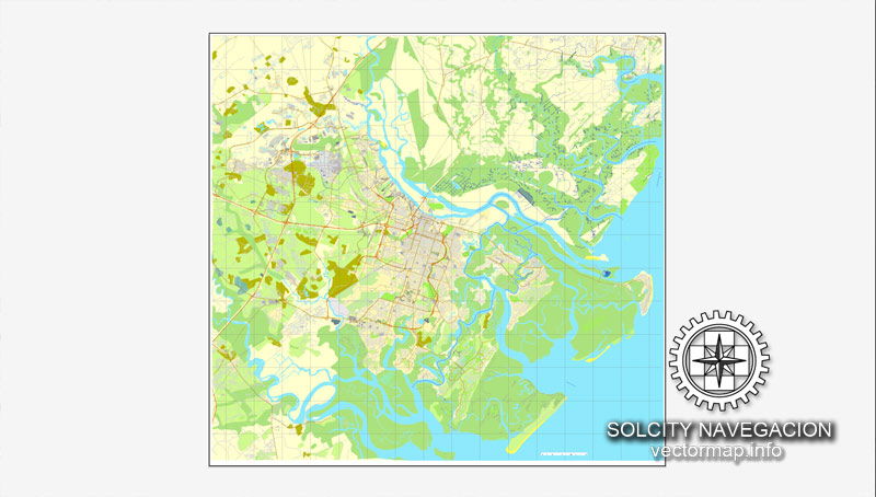 Maps of Georgia tend to be an very helpful piece of family history research, particularly if you live faraway from where your ancestor resided. Due to the fact Georgia political boundaries oftentimes changed, historic maps are significant in assisting you uncover the exact specific location of your ancestor’s hometown, what land they owned, just who their neighbors ended up being, and much more.
Maps of Georgia generally are likely to be an outstanding reference for getting started with your research, since they provide you with significantly valuable information and facts quickly. Georgia Maps are usually a major source of considerable amounts of information and facts on family history.
Get a bird’s eye view of the entire Metro Savannah area, including the islands, with this easy-to-see overview map of Savannah. Whether you are exploring Savannah by car or on foot, our simple maps can help you oriented, and get you to your destination and start having fun! Being a walking city, Savannah lends herself to those beautiful afternoons just exploring and strolling through the city. Don't venture too far without a map of Savannah! Download a PDF of our Downtown Savannah Map now!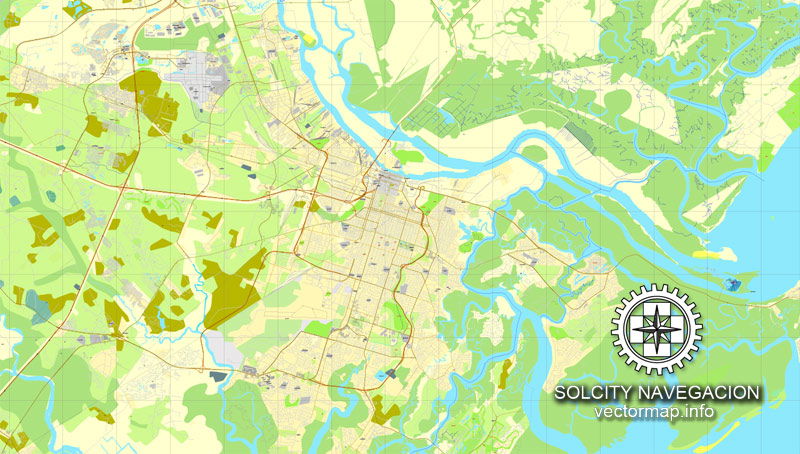 The Savannah, GA City Map offers an affordable medium-detail vector map of the greater metropolitan area in editable Illustrator or PDF format. Each individual layer can be individually edited or easily turned off, allowing the designer a great deal of flexibility to show or hide as much detail as is required by the project. See the sidebar for a complete list of features / layers available on this digital map.
This Savannah, GA City Map also contains border outlines for the following neighboring cities: Garden City, Pooler, Port Wentworth, Savannah, Thunderbolt, Vernonburg
Additional Info
These blank city maps are made from government data sources. Data quality varies throughout the country due to different data sources. Some maps may have missing street lines, ownership borders, annexes, and label errors which we have no control over. Maps should be used for general overviews of cities, road networks, borders, and regions and not as a close-up representation of city streets. These maps have a resolution of 300 dpi so it is suggested that no more than a 200-300% zoom be used, since major distortion will show at greater zoom levels.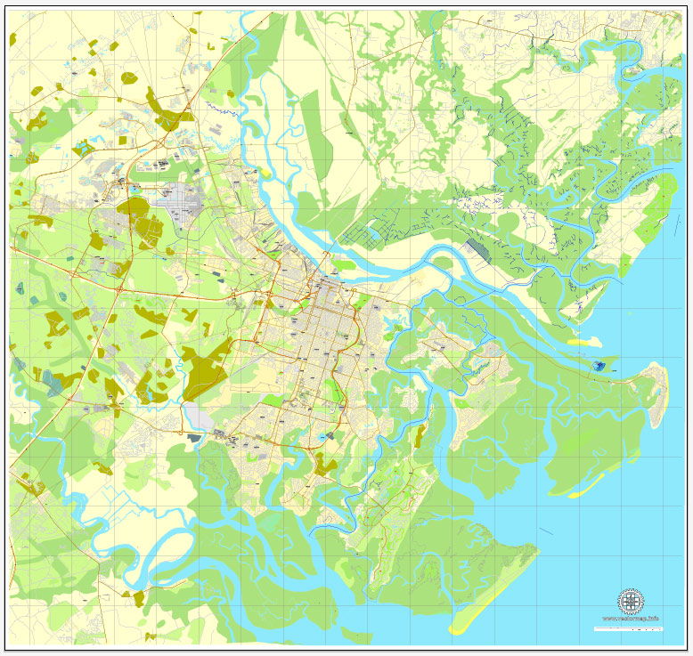 This map is also delivered as a fully-editable Adobe PDF map file. This raw PDF file can be opened using the free Adobe Reader software, which allows you to zoom into any portion of the map while maintaining crisp lines and text at any level of magnification. All of our Adobe PDF map files can be easily incorporated into a wide range of other software products, such as Microsoft Word and PowerPoint, as well as Adobe Photoshop and Illustrator. Our PDF maps are also 100% editable in Illustrator 10 and higher, allowing you to select and edit any object on the map (such as state/county/country boundaries, road lines, map symbols, text, etc.). All major map objects reside on their own intuitively labeled layers, allowing you to easily show/hide, edit and delete each main map object. For a complete list of features/layers, refer to the list in the sidebar.
The Savannah Historic District Illustrated Map was the winner of the Best Recreational/Travel Map in the 40th Annual Cartography and Geographic Information Society (CaGIS) Map Competition (2012). We love the amazing detail. Easy to read and easy to navigate, this is a street map and travel guide in one. You'll discover fascinating facts while finding your way around the Historic District. Order your copy today!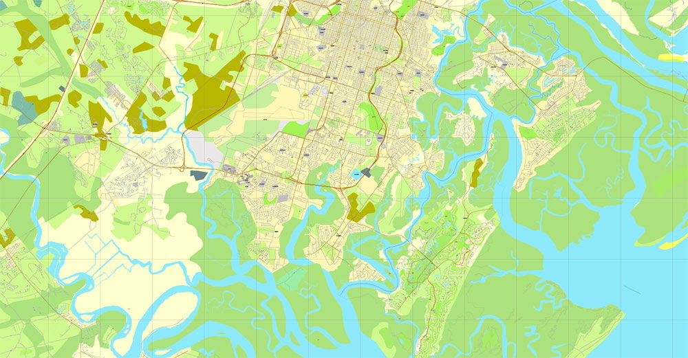 The states bordering Georgia are Florida in the south, Alabama to the west, Tennessee and North Carolina in the north and South Carolina to the east. Georgia’s 10 largest are largest cities are Atlanta, Augusta-Richmond County, Columbus, Savannah, Athens-Clarke County, Macon, Roswell, Albany, Marietta and Warner Robins.
Articles
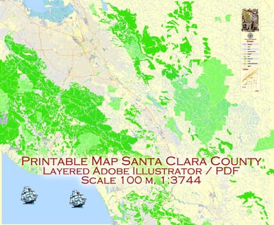
All of our editable Santa Clara vector maps are instantly downloadable digital files in either editable PDF or Adobe Illustrator format. Because each of our Santa Clara digital maps is available in the Adobe Illustrator or editable PDF format, both of which use a vector based approach to displaying images, you can easily zoom into any portion of our maps without any degradation in the quality of the text, lines and symbols of the map --- regardless of the magnification factor.
Read More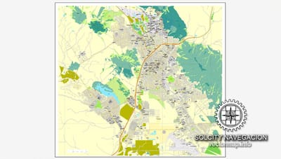
This San Luis Obispo Map with Roads, Highways & Zip Codes is a fully editable, layered Adobe Illustrator file. Adobe Illustrator files are vector format files, allowing for crisp, high-quality artwork at any magnification. All major map objects / features reside on their own layer. For a complete listing of objects/layers, refer to the list in the sidebar. Printable San Luis Obispo County, CA topographic maps, GPS coordinates, photos, & more for popular landmarks in San Luis Obispo County including San Luis Obispo, Atascadero, and Arroyo Grande.
Read More
The Charleston, SC City Map offers an affordable medium-detail vector map of the greater metropolitan area in editable Illustrator or PDF format. Each individual layer can be individually edited or easily turned off, allowing the designer a great deal of flexibility to show or hide as much detail as is required by the project. See the sidebar for a complete list of features / layers available on this digital map.
Read MoreServices
Philadelphia printable maps in PDF, Pennsylvania
Philadelphia Street Map Map Description Philadelphia, Pennsylvania: Travel maps for business trips, address search, tourist attractions, sights,airports, parks, hotels, shopping, highways, shopping malls, entertainment, and door to door driving directions. Favorite tourist destination points Philadelphia include Congress Hall, Cliveden, Reading Terminal Market, Independence Hall, Philadelphia Zoo, Independence National Historical Park, and Fairmount Park. Map Instructions Driving Directions: To view Philadelphia map, use the zoom or pan controls to change map distance, street view, or direction of sight. Detailed hi-res maps of Philadelphia for download or print.
Learn More